[Update: Nov. 27, 2018 ... A road report following my first rainy night drive on the improved Sooke Rd: "First time this winter driving #14 in somewhat lousy conditions last night and happy to say it was a breeze for me. The broadened white perimeter lines were my guide and a ton of strategically placed roadside posts, reflective lights and markings carried me smoothly from one bend to the next. Such a dramatic difference to a few years ago, or even last year at this time. Last night, the wipers were working hard on the way to Royal Roads, and there were fog patches on the return. Nonetheless, it was a relaxed, flesh-toned knuckles drive while listening to CFAX for a time (BC legislature speculation, natch) and some pleasure with a mix CD featuring a few classics like this one. So yes, go Johnny go, drive cautiously, always and ever, but do so with renewed confidence that the pros at the Ministry of Transportation are doing a superb job in making it a safer route."]
Hwy #14 (like health care, death and taxes) will always and ever be an ongoing obsession for us locally.
Dedicated local social media sites buzz with daily updates about road conditions, accidents and, in recent weeks, McKenzie exchange construction crawls. Strategies on how to deal with our two lanes-that-could-be-four were a prime issue in the 2017 provincial election. And some locals wanted to highlight #14 in this fall's Sooke election even though it's a provincial, not municipal, matter ~ not that this distinction downplays our essential role as advocates, officially as a District and as individual citizens. (Locals are the true, real-world authorities on the subject, more so than MOTI's Nanaimo-based civil servants). Apt, then, that Gord Phillips' "Sooke Highway" is our unofficial civic anthem. (Such a pleasure to singalong with him and it during the recent Sooke Talks #2).
As everyone knows, phased highway improvements have accelerated, deservedly so given the problems, with our MLA's ascension to the Premier's job. Yet the growing number of cars on the road and its in-built shortcomings remain a matter of deep concern, especially now that the early nightfalls and heavy rains are back for another season of winter drives ~ white-knuckle ones, in my and many experiences on certain downpour nights, when navigating a happily rare few tricky twist-turn-and-dip stretches (especially when contending with new-breed headlights that beam unpredictable degrees of brightness and intensity). Result: Some heart-in-mouth scares I remember vividly as 'this could be it' moments. Again, this hasn't happened often - it takes a certain combination of darkness, rain, rush hour lights and fast-beating windshield wipers to get me off my 70 kmph (dry conditions, traffic dependent) Sooke Rd. game. I like driving this road: Minus the heavy traffic, it's pure car commercial country. (As I've said before, there is pullover, slow-track tourism potential with basin and Goose access should MOTI's Connie-Harbourview straightening of #14 one day proceed ~ pending negotiations with landowners and the North Sooke Community Association).
Anyway, while there have already been notable safety improvements, a fresh wave of alarm has nonetheless arisen on social media about the relative ineffectiveness (for some drivers) of the newly repainted, broader perimeter road markings during foul weather. The common theme: "They're too indistinct, they vanish in the rain, we don't feel safe, and something tragic will inevitably happen without a lasting fix"
I shared a sampler of these concerns in a Nov. 1 email to the BC Ministry of Transportation and Infrastructure's Kristen Reimer. At the Hwy #14 Open House in June at EMCS, I'd suggested to her and other MOTI staff that the engagement process would be improved if ministry staff routinely tracked the steady flow of comments, concerns and bright ideas posted on Sooke social media. (I also suggested MOTI honour Sooke's Transportation Master Plan in making its decisions, i.e. heed our roundabout-first policy at Sooke River Road rather than installing a signal light -- the cost for what would have had to be a double-laned traffic circle would have been prohibitive, I was told, so we must accept what we're given with good grace.)
Not long after that open house, I sent Ms. Reimer (with a cc to MLA Horgan) a file of Hwy #14 Facebook comments that I'd collected over the years. And, in the wake of the latest concerns after the season's first torrential downpour just before Halloween, I did so again.
She replied the other day with the following email:
"I chatted with Shawn Haley, our Road Area Manager responsible for this section of road, about your concern and he let me know that Highway 14 has been painted twice already this year with a reflective beaded paint. He also informed me that, going forward, we will be painting our major numbered routes twice a year (as opposed to just once, which we historically have done).
As you may be aware, the province historically used lead based paint, but due to environmental issues, we have switched to a material that’s water based. We are working on finding the perfect balance between being environmentally friendly, and highly reflective and durable. Here’s a link to a blog outlining our quest for the perfect paint: https://www.tranbc.ca/2017/09/27/new-tool-shines-a-light-on-line-paint-brightness/
We’ve also recently installed street lights at key intersections along the route – which went active on Oct 31, 2018. We expect at least three more to come online very soon.
It’s also important for all drivers to remember that when conditions are wet, it’s dark, and there’s oncoming traffic, motorists need to slow down and drive to conditions.
If you have any further questions or concerns, don’t hesitate to let me know. I also really appreciated hearing your positive feedback on the work being done to improve BC Highway 14 J
You can also connect with us online by clicking on any of the icons listed below my signature.
Thanks again for connecting with us. Safe travels.
Kristen Reimer
Information Officer, iPAS Business Manager
Web and Social Media Services
Ministry of Transportation & Infrastructure
PO Box 9850 Stn Prov Govt I Victoria I BC I V8W 9T5
778-974-5305 Kristen [email protected]
So that's where things stand at the moment. Essentially, we must all heed the message of "drive safe, slow down, take care." Wise advice always! Personally, I've not yet experienced a daunting drive this winter, but I can certainly relate to what some FB commentators have said about how 'muscle-memory' and 'pure faith' have helped them through the worst passages. Driving slow works to a degree, though only if everyone else is being patient and doing likewise.
Which brings me back to the subject of advocacy: It's critical that the District, council and citizens alike maintain the pressure. Phone or write MOTI Area Roads Manager Shawn Haley at 778-974-2627; [email protected]. And cc our Mr. Horgan in the process: [email protected].
Meanwhile In Sooke member Susan Jones has been sharing the following useful contacts as well:
* Main Road South Vancouver Island: 1-877-391-7310; [email protected]
* Minister of Transportation and Infrastructure Claire Trevena: 250-387-1978; [email protected]
* MOTI Deputy Minister Grant Main: 250 387-3280
As she says, phoning and emailing "will get action if enough people do it."
Further Background (Misc)
Perspective
* Elida Peers documents history of Sooke Road
* MOTI, regional districts, municipalities and logging companies are variously responsible for nearly 50,000 km
of paved + 22,000 km unpaved roads in BC
* Canada's National Highway system
* Canadian Encyclopedia: Roads & Highways in Canada
* Province of BC's Driving & Transportation home page
* BC's 12 Deadliest Highways (#14 does not feature on this list based on ICBC stats from 2004-13)
Highway 14 & Regional Studies
* BC Ministry of Transportation Highway 14 Route Study (1991; viewable by request at Sooke's Municipal Hall)
* District of Sooke's Transportation Master Plans (2000, 2009 and now being revised for 2019)
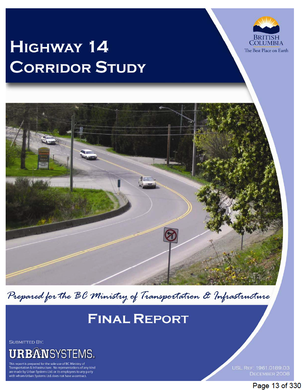
* MOTI Highway 14 Corridor Study (2008; copy in the agenda package dated Sept. 27, 2018 on the District's website.)
* Capital Regional District's Regional Transportation Plan (1990s, revised 2014)
* CRD Origin Destination Travel Household Survey (2011)
* CRD Pedestrian and Cycling Master Plan (2015)
* CRD Household Travel Survey (2017)
* Drive BC Road Conditions + BC Map + #14 updates here
Highway 14 Improvements (2011-present)
* Aug. 2011: "Sooke-tacular Improvements Come to Highway 14" (MOTI newsletter)
* 2012: Highway 14 improvements (MOTI newsletter re: fixing the flood zone west of Kangaroo Rd.)
* Jan., 2018: "Mayors Call for Action" (Maja Tait, Stew Young)
* Jan., 2018, Premier Horgan announces $10m in funding for road improvements.
* June 2018: This preliminary report from MOTI kickstarted the Sooke community engagement process
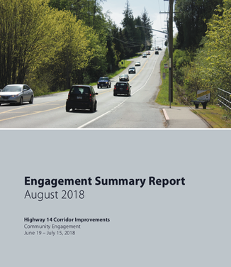
* Aug., 2018: Engagement Summary Final Report.
Topping Sooke's consensus wish list: i) Improved paint lines; ii) More roadside delineation/reflectors; iii) Highway realignments; iv) Additional passing opportunities; v) Improved street lighting; vi) Improved intersections; vii) Speed-reader boards and more RCMP traffic enforcement.)
* Sooke PocketNews Highway 14 archive
* Advocacy by the #DividedBy14 initiative of the Sooke Economic Development Group
* Advocacy by the Otter Point and Shirley Residents & Ratepayers Association
* Advocacy by the Sooke Chamber of Commerce
* Westshore Voice News article on Transition Sooke's "Rethinking Traffic As Usual" workshop (Nov. 2017)
* CRD Transportation Committee minutes (2017/18)
* ICBC Crash Spots Van Isle: 2013-17 (search: Sooke)
* "Surveillance camera catches Sooke Rd. crash" (Sept. 14, 2018)
Sooke Local Road Issues
* District of Sooke Business Case Phase Two (Phillips to Charters) of Connector Road Project
* Sooke Borrowing Referendum 2005 backgrounder
* Wadams Way opening (Oct. 2014)
* "Roundabout part of $9 million in Sooke roadwork" (July 2015)
* "Sooke's new Brownsey Blvd. Now Open" (June 2016)
Colwood (and Malahat) Crawl
* Westshore Parkway Langford
* Jack Knox Times Colonist column: "Is the Colwood Crawl Driving You Crazy?" (Nov. 2018)
* "New 'Urgency' to find Malahat Highway Alternative" (CBC interview with Minister of Transportation Trevena)
Alternatives: Light Rail & Rapid Buses
* Victoria Regional Rapid Bus Project (BC Transit, spring 2011)
* Premier Horgan: "Rapid-bus system from Westhills to downtown Victoria would be a better bet." (May, 2018)
* "Region's Politicians Laud Movement" re: Langford-Victoria LRT (May 17, 2018)
* Better Transit Alliance of Greater Victoria
* Victoria Region Bus Lanes Project (BC Transit, updated 2018)
* Island Corridor Foundation (reviving the E&N Rail line from Victoria to Courtenay)
* E&N Rail Reports & Studies (Province of BC)
* "Rail for Vancouver Island" Facebook group
* MOTI Trans-Canada/Malahat Corridor Study (2007)
* Victoria Transport Policy Institute
* Regional Transit Funding Options (CRD, 2012)
* Transportation Service Feasibility Study (CRD, 2014)
BC Transit
* BC Transit "Advantage" Newsletter
* Sooke Local Area Transit Plan study begins (Fall/Winter, 2018)
* Westshore Local Area Transit Plan (completed 2014)
A few key facts about #14
* Annual average daily traffic volume = 16,000 cars per day (up 25 percent since 2007)
* Hwy #14 is closed an average of six times a year (usually for two hours, but as long as seven hours or more, as per the early October closure this year)
* Most dangerous spots: Gillespie Rd., Cooper's Cove, Parkland, Otter Point/Murray, Sombrio
Source: 2018 MOTI report. Clip: "Annual average daily traffic (AADT) volumes along the corridor have increased by approximately 25% over the past 10 years. The corridor is experiencing increasing platoons of commuter traffic (where congestion causes vehicles to travel closely together), and areas west of Sooke lack shoulders, pullouts and pavement conditions are of concern for this important tourism and commercial route."


 RSS Feed